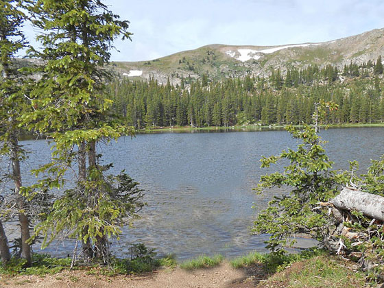
Waterdog Lake 
Distance: 7.8 miles (round trip)
Uncompahgre National Forest, near Lake City in Southwest Colorado
A stiff climb leads to a scenic bench and a pretty lake high above the east side of the Lake City.
See Trail Detail/Full Description
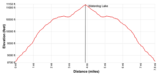
- Distance: 7.8 miles (round trip) to Waterdog Lake
- Elevation: 8,730-ft. at Trailhead
11,130-ft. at Waterdog Lake - Elevation Gain: 2,400-ft. to Waterdog Lake
- Difficulty: strenuous
- More Hikes in:
Lake City / Southwest Colorado
Why Hike Waterdog Lake
Waterdog Lake sits in the timberline bowl beneath Mesa Seco (12,800-ft.), high above the east side of Lake City. The first half of the hike is a sustained steep climb up switchbacks, passing through Douglas firs and then lovely aspen groves. The stiff climb leads to scenic Horse Park, a high bench clad in pretty meadows scattered with aspens. Here the grade abates as the trail curves around the north end of the park to meet a jeep road. A moderate climb up the forest lined road leads to the pretty lake.
Meadows and openings in the forest along the trail offer views of Lake City and the peaks towering to the south of the Henson Creek Valley. Station Eleven (10,726-ft.) rises along the west side of Horse Park while Crystal Peak is seen to the west.
The hike offers a great workout and is a good option if weather is threatening the high country to the west. Topping out at 11,130-ft. also makes this a good shoulder season hike or an option for fit hikers trying to get acclimated.
Elevation Profile

Buy the BookThis opinionated guide includes all the hikes in the Ouray, Telluride, Silverton and Lake City sections of the website plus info on local services and nearby attractions. | |
Trail Resources
Trail Detail/Full Description / Trail Photo Gallery / Trail Map
Basecamp(s) Information:
Lake City
Region Information:
Southwest Colorado
Other Hiking Regions in:
Colorado

