Oak Creek 
Distance: 6.0 - 7.0 miles (round trip)
Uncompahgre National Forest, near Ouray in Southwest Colorado
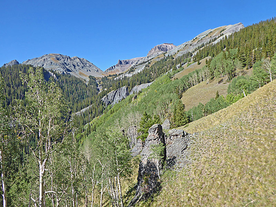
Nice views of Hayden Mountain, Whitehouse Mountain and the Uncompahgre River Gorge are the highlights of this hike up pretty Oak Creek Canyon to an overlook on the southern flank of Twin Peaks.
See Trail Detail/Full Description
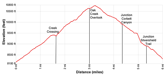
- Distance: 6.0 miles (round trip) to Overlook
7.0 miles (loop) to Silvershield via Loop - Elevation: 8,150-ft. at Trailhead
10,640-ft. at Overlook
10,760-ft. at Silvershield via Loop - Elevation Gain: 2,490-ft. to Overlook
-3,120-ft. to Silvershield via Loop - Difficulty: strenuous
- More Hikes in:
Ouray / Southwest Colorado
Why Hike Oak Creek
The Oak Creek Trail is a good option if the weather precludes hiking in the high country. The trail, which starts in Ouray, provides a good workout and is a nice choice for parties trying to get acclimated. Fine views of the surround peaks and valleys, a pretty waterfall and some old mine tunnels add interest to the walk. From the overlook great views extend southeast down the Uncompahgre River Gorge. Hayden Mountain towers over the valley to the south while Whitehouse Mountain dominates the view to the west. To the east are the high peaks rising above the Amphitheater.
Continue the Oak Creek hike beyond the overlook by climbing over a low saddle and then descending the wooded hillsides on the north side of Twin Peaks to the Silvershield trail. The Silvershield trail descends to Oak Street, a mile to the north of downtown Ouray.
Elevation Profile

Buy the BookThis opinionated guide includes all the hikes in the Ouray, Telluride, Silverton and Lake City sections of the website plus info on local services and nearby attractions. | |
Trail Resources
Trail Detail/Full Description / Trail Photo Gallery / Trail Map
Basecamp(s) Information:
Ouray
Region Information:
Southwest Colorado
Other Hiking Regions in:
Colorado

