Spencer Basin 
Distance: 4.2 - 7.7 miles (round trip)
Gunnison BLM, near Silverton in Southwest Colorado
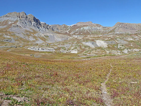
An old mining road leads to the heart of Spencer Basin, a beautiful, unspoiled and seldom visited valley surrounded by 13,000-ft. peaks. Here use trails and routes lead to two scenic passes.
See Trail Detail/Full Description
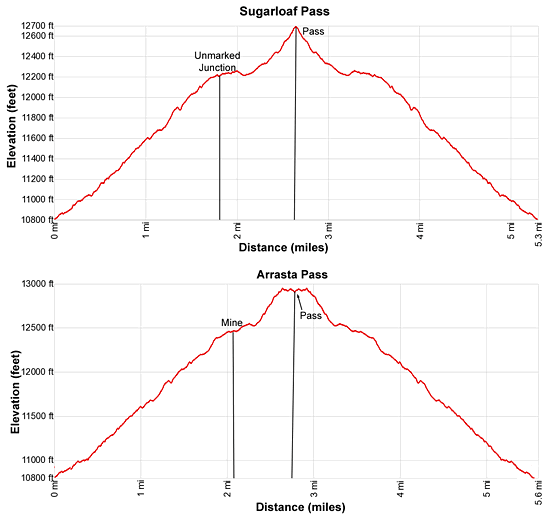
- Distance: 1.8 miles (one way) to Sugarloaf Pass Junction
5.6 miles (round trip) to the Mine & Arrastra Pass - Elevation: 10,830-ft. at Trailhead
12,220-ft. at Sugarloaf Pass Junction
12,940-ft. at the Mine & Arrastra Pass - Elevation Gain: 1,400-ft. to Sugarloaf Pass Junction
2,110-ft. to the Mine & Arrastra Pass - Difficulty: moderate-strenuous
- More Hikes in:
Silverton / Southwest Colorado
Why Hike Spencer Basin
Beautiful Spencer Basin is a little known gem to the northwest of the Highland Mary Lakes. An old mining road climbs into the heart of the basin where trails and routes lead to the remnants of a mine and two passes. The solitude and untrammeled condition of the basin adds to the allure.
There are actually three destinations in this large basin that can be combined to create hikes of varying lengths and difficulties. Experienced hikers adept at scrambling will find additional areas to explore.
The trailhead is best reached by a high clearance vehicle. Low clearance passenger vehicles will need to park at the mine ruins near the end of County Road 4 and walk to the trailhead, adding 1.6 miles round-trip to the total distance.
Elevation Profile

Buy the BookThis opinionated guide includes all the hikes in the Ouray, Telluride, Silverton and Lake City sections of the website plus info on local services and nearby attractions. | |
Trail Resources
Trail Detail/Full Description / Trail Photo Gallery / Trail Map
Basecamp(s) Information:
Silverton
Region Information:
Southwest Colorado
Other Hiking Regions in:
Colorado

