Lower Calf Creek Falls 
Distance: 5.8 miles (round trip)
Grand Staircase-Escalante National Monument, near Escalante in South Central Utah
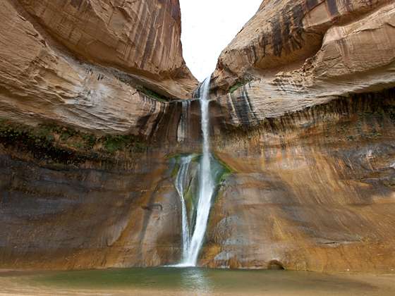
This good introductory hike to the Escalante National Monument travels up a scenic canyon and leads to the base of lower Calf Creek Falls, a beautiful 126-ft. tall cascade.
See Trail Detail/Full Description
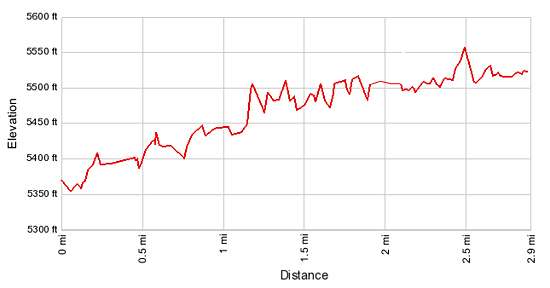
- Distance: 5.8 miles (round trip) to Lower Calf Creek Falls
- Elevation: 5,350-ft. at Trailhead
5,550-ft. at Lower Calf Creek Falls - Elevation Gain: 200-ft. to Lower Calf Creek Falls
- Difficulty: easy
- More Hikes in:
Escalante / South Central Utah
Why Hike Lower Calf Creek Falls
Calf Creek, a south-flowing tributary of the Escalante River, has carved a deep canyon into the Navajo Sandstone and Kayenta Formations. Within the canyon are two beautiful waterfalls, Upper and Lower Calf Creek Falls. This easy, popular trail travels along scenic Calf Creek Canyon and leads to the base of the stunning lower falls set amid a shady oasis.
This is not a trail for hikers looking for solitude. The path gets quite crowded during the height of the spring/fall season and on weekends.
Elevation Profile

Trail Resources
Trail Detail/Full Description / Trail Photo Gallery / Trail Map
Basecamp(s) Information:
Escalante
Region Information:
South Central Utah
Other Hiking Regions in:
Utah
